|
Paragraphs
extracted from
the Traveler's Ecuador Companion © The
Globe Pequot Press. Reproduced with permission.
Photos
by Dominic Hamilton.
 Ecuador
is a gallery of stunning landscapes. From snow-capped, volcanic
mountains and long stretches of unspoiled coastline to Amazon
rainforests and the bleak splendor of the Galápagos
Islands, the country offers the visitor a breathtaking spectrum
of natural wonders. To give you an idea of its diversity,
of the world's 32 denominated "Life zones", 26 are found here,
in a country the size of Nevada, or slightly larger than the
United Kingdom. Ecuador
is a gallery of stunning landscapes. From snow-capped, volcanic
mountains and long stretches of unspoiled coastline to Amazon
rainforests and the bleak splendor of the Galápagos
Islands, the country offers the visitor a breathtaking spectrum
of natural wonders. To give you an idea of its diversity,
of the world's 32 denominated "Life zones", 26 are found here,
in a country the size of Nevada, or slightly larger than the
United Kingdom.
Including the
Galápagos Islands, Ecuador consists of four contrasting
regions, each one distinctly different from the others. The
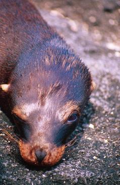
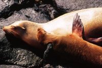
Galápagos are arid, volcanic outcrops patterned
with moon-like lava flows and twisted rock formations. No
soft Pacific palms fringe their rocky shores. Plants and creatures
here that have adapted to these harsh conditions are tough
and hardy - thick-skinned iguanas, giant armor-plated tortoises,
blubber-bound sea lions, spiny acacia, spiky cactuses, saltbush
and scalesia.
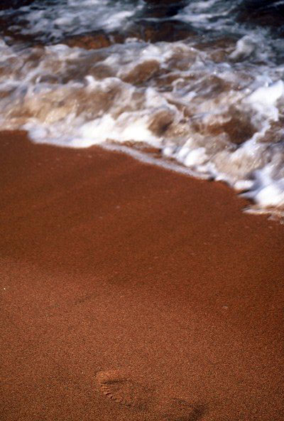
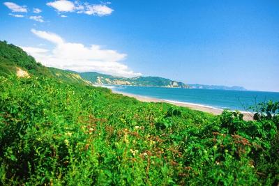
The coastline
and the coastal plain, simply called La Costa, present
a less fierce face - marshland, mangrove swamps (or what is
left of them after the invasion of shrimp farms), creeks,
estuaries and long stretches of empty beaches swathed with
palm trees. The hot and humid coastal plains were thickly
forested before man arrived with his machete to create banana,
cacao, coffee, sugar cane and rice plantations. As these plantations
encroached further upon the forest, Ecuador became a full-fledged
banana republic and still ranks among the world's leading
exporters.
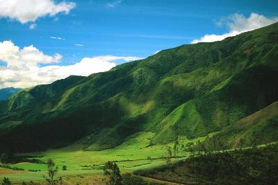
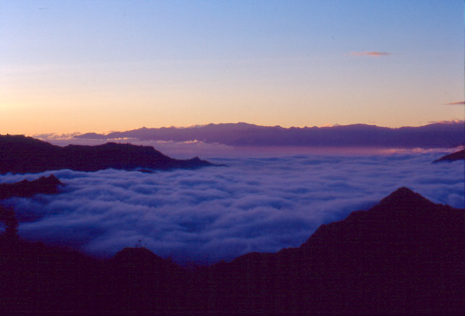
Upwards and eastwards,
the flanks of the Andes are clothed in mists and residual
areas of thick cloud forests threaded with silvery waterfalls.
In the highland valleys, the Sierra, the face of the
landscape takes a more worn and hewn look. Tilled and re-tilled
for centuries before the Incas and the Spanish came along,
the ancient, geometric fields, terraced on the steeper slopes,
transform the valleys into tapestries woven in pastel shades
of brown and green. Splashes of deep red on the ponchos of
Indian women herding sheep provide a vivid color contrast,
while lamas grazing by high mountain lakes embellish the pastoral
scenes. Above the valleys tower snow-white peaks, stern and
dangerous, the world's tallest active volcanoes.
 Over
the other side of the mountains, the eastern slopes of the
Andes stretch towards the great Amazon basin, the world's
largest rainforest. The Ecuadorians call this vast area of
their country El Oriente, The East. The discovery of
oil in the Oriente in the 1970s has led to the building of
new roads, destruction and contamination of huge tracts of
virgin forest and increasing numbers of "colonists," as well
as new diseases, cultural decimation and anger within the
local indigenous populations. Rivers flowing down the Andes
and through their tribal lands eventually link up with the
mighty Amazon River on its 3,200-km (2,000-mile) journey across
Brazil and into the Atlantic Ocean. Over
the other side of the mountains, the eastern slopes of the
Andes stretch towards the great Amazon basin, the world's
largest rainforest. The Ecuadorians call this vast area of
their country El Oriente, The East. The discovery of
oil in the Oriente in the 1970s has led to the building of
new roads, destruction and contamination of huge tracts of
virgin forest and increasing numbers of "colonists," as well
as new diseases, cultural decimation and anger within the
local indigenous populations. Rivers flowing down the Andes
and through their tribal lands eventually link up with the
mighty Amazon River on its 3,200-km (2,000-mile) journey across
Brazil and into the Atlantic Ocean.
Some 17% of Ecuador's
land area is officially designated as national parkland, nature
reserve or special recreation area. All of the country's ecosystems
are protected in some form or another. The first national
park created was the Galápagos Islands in 1959 and
the first mainland park was Cotopaxi in 1975. Since then,
many more national parks have been created: Machalilla, Yasuni,
Sangay, Podocarpus, to name just a few.
 In
addition there are huge areas of protected nature reserves,
the largest being Cotacachi-Cayapas, Cayambe-Coca and Cuyabeno,
all in the north of the country, as well as national recreation
areas, natural monuments and private reserves. The largest
of the last category are run by foundations, such as Ecuador's
largest environmental NGO Fundación
Natura Tel (022) 447341 to 4, Av. America 5653 and Voz
Andes, Quito, natura@natura.ecx.ec
www.latinsynergy.org/naturaecuador.htm In
addition there are huge areas of protected nature reserves,
the largest being Cotacachi-Cayapas, Cayambe-Coca and Cuyabeno,
all in the north of the country, as well as national recreation
areas, natural monuments and private reserves. The largest
of the last category are run by foundations, such as Ecuador's
largest environmental NGO Fundación
Natura Tel (022) 447341 to 4, Av. America 5653 and Voz
Andes, Quito, natura@natura.ecx.ec
www.latinsynergy.org/naturaecuador.htm
If you have the
time it is well worth visiting four national parks representing
the four major ecosystems of the country. The Galápagos
Islands, with their extraordinary wildlife, are an experience
of a lifetime. In the Andes, the most frequently visited national
park is Cotopaxi, with its magnificent, cone-shaped
volcano, the tallest active volcano in the world. The Machalilla
National Park on the coast is stunningly beautiful, and
the Yasuni National Park or Reserva Faunística
Cuyabeno in Amazonia provide a unique insight into rainforest
wildlife.
Some of the parks
and reserves are remote and difficult to reach and facilities
aren't well developed. Visitors planning to stay a few days
are advised to bring their own camping gear, water and adequate
supplies. The entrance fees for national parks are generally
US$10 for a highland park and US$20 for a lowland park, but
some also vary according to tourist season. One payment allows
multiple entry to the park for a week. Ecuadorian nationals
pay considerably less. The entry fee to the Galápagos
National Park is currently US100 for foreigners.
Even
though a portion of the comparatively high entrance fees goes
towards administration and protection, sufficient manpower
and equipment aren't available to prevent various kinds of
destruction. Areas of some of the parks and reserves have
been subject to illegal fishing, oil drilling, mining, ranching
and colonization. The effects of the oil and logging industry
on the Oriente have been particularly devastating.
For
more information on parks and reserves contact Ministerio
del Ambiente (Ministry of the Environment) (022)
548924 www.ambiente.gov.ec
(in Spanish),
in the monolithic eye-sore of a building at the corner of
Eloy Alfaro and Amazonas.
Over the years, the parks system has come under various administrative
agencies. However, contact details throughout the country
should, hopefully, remain the same, even if the names change...
Below,
you'll find information on the most visited and accessible
parks and protected areas in different parts of the country.
It is not exhaustive, but we trust it will be useful.
by
clicking on the 'back' arrow you will return to this menu
For
the Galápagos, go here
AROUND
QUITO:
Pasochoa
Forest Reserve
A subtropical forest area less than an hour's drive southeast
from Quito. Popular for school outings, the reserve attracts
some 20,000 visitors per year. Several mapped trails criss
cross an extinct volcanic crater rich with plants and wildlife.
There are camping and hostel facilities in the park, but no
shops or restaurants. For maps and more information contact
Fundación Natura, which runs the reserve.
 Mindo
and Maquipucuna Reserve Mindo
and Maquipucuna Reserve
The small town of
Mindo on the western slopes of the Andes, just 40 km
(25 miles) northwest of Quito as the condor flies, is
a mecca for cognoscenti bird-watchers. In the dense surrounding
cloud forest some 450 species have been observed, including
such trophies as the fabulous scarlet-crested Andean cock
of the rock, the toucan barbet, the plate-billed mountain
toucan and the velvet-purple coronet.
About 32 km (20 miles) north of Mindo, on the same
western slopes of the Andes, is the Maquipucuna Biological
Reserve, most of which is primary cloud forest. In this
wildlife-rich area, species of close to 2,000 plants, of some
322 birds, more than 200 butterflies and 45 mammals have been
recorded. It's no wonder that Maquipucuna attracts naturalists
like moths to a flame. For information about lodgings, prices
and transport to the area contact Fundación Maquipucuna
tel (022) 507200 or 507202 fax (022) 507201 e-mail abi@maqui.ecx.ec..ecx.ec;
in Quito at Baquerizo 238 and Tamayo, PO Box 17-12-167.
Antisana
Ecological Reserve
Although little known
and difficult to get to get to, the Antisana Ecological
Reserve, 57 km (36 miles) southeast of Quito,
offers breathtaking scenery of the páramo and views
of the eponymous, snow-capped mountain where wild horses roam
and condors cross the sky. This dramatic wilderness is a great
place for riding, hiking, camping and living in the wild.
Visitors must bring their own supplies, though there's a lodge
owned by a water company where it's possible to stay. Access
is by car only (4-wheel drive recommended) and a permit is
required. For more information contact Fundación
Antisana tel (022) 433851 in Quito, Mariana de Jesús
and Carvajal. You can also get special permission to enter
the territory of Hacienda Pinatura, owned by Carlos Delgado
who can be contacted at Avenida de Diciembre 1024 in Quito.
Or make inquiries on the way to the reserve at Píntag,
where you can find a guide.
THE
NORTH
Cotacachi-Cayapas
Ecological Reserve
The enormous
park stretches down the western highlands to the tropical
lowlands of Esmeraldas Province. As well as the highlands,
it protects the rich and humid cloud forests, populated by
a huge diversity of plants, birds and mammals, are disappearing
even faster than the better-known rainforests. Deforestation
on the western slopes of the Andes is threatening the survival
of mammals such as mountain tapirs, spectacled bears, spider
monkeys and pumas.
Laguna de Cuicocha is about 16 km (10 miles)
west of Cotacachi (just northwest of Otavalo).
This deep, blue crater lake with two islands in the middle
is a popular recreation area on weekends. Motor boats can
be rented to explore the lake, though the islands are off
limits because of research projects. A walk around the lake
takes about five hours. Be warned: those berries that look
like blueberries are something else - and they are poisonous.
A round-trip by taxi from Cotacachi costs about US$10, and
there are two decent restaurants nearby, as well as a modest
place to stay on the hill.
Just south of the reserve and about 40 km (25 miles)
west of Laguna de Cuicocha is the remote village of
Apuela, set in the deep Andean cloud forest. Nearby
are the Nangulvi Thermal Baths. Basic accommodation
is available. There are a few buses each day along the scenic
but jolting road between Otavalo and Apuela.
Intag
Cloud Forest Reserve
Begun by two
ecoactivists, Carlos Zorilla and Sandy Statz, the reserve
is in the vicinity of Apuela, and is a model of environmental
friendliness. Rustic wooden cabins, solar-generated electricity
and homegrown vegetables are indicators of their philosophy.
Visitors can see their operation and explore the jungle for
themselves at US$45 per person per day, including all meals
and guides. For advance reservations fax (06) 923392
intagcz@uio.satnet.net
, or write to Intag at Casilla 18, Otavalo, Imbabura, Ecuador,
giving at least two months notice. Bosque Nublado de Santo
Tomás is a similar operation in the same area.
Reserva
Ecológica El Ángel
An area of mystical lakes, windswept grasslands and the curious,
hairy-leafed, tree-like frailejón plant, said to be
the biggest plant in the world. El
Ángel is one of the best places to enjoy
the páramo habitat.
Heading north on the Pana, at Mascarilla (about
33 km or 20 miles) out of Ibarra, the road forks. The
Panamericana continues to the right, while to the left, the
old road to Colombia bumps up to La Mira 15 km (nine
miles) away, famous for its firework fiestas (particularly
on February 2 for the Virgen de la Caridad). The route up
from La Mira leads to the friendly highland village of El
Ángel (a further 25 km or 15 miles) from La Mira,
and the access point to the Páramo del Ángel.
If you want to explore this little-visited ecological reserve,
ask for the offices of the Fundación El Ángel,
or take a tour with the best hotel in town, the Hostería
El Ángel Z/fax (06) 977584 rsommer@ecuanex.net.ec
, which is by the traffic circle to the south of the town.
Rooms are spick and span and comfortable, meals decent, and
tours (on foot, horse or bike) excellent. Fundación
Golondrinas also is also active in conservation work in
the area and organizes treks from El Angel. For details contact
tel (022) 226602 fax (022) 566076 email manteca@uio.satnet.net,
Isabel La Católica 1559.
You can also gain access to the páramos from Tulcán
(the Colombian border town). Head west to the little village
of Tufiño, where there are some lovely thermal
springs nearby, and continue climbing to the highlands around
Volcán Chiles. Ask the tourist office in Tulcan for
transport practicalities.
CENTRAL
HIGHLANDS
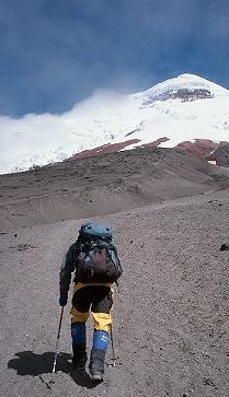 Cotopaxi
National Park Cotopaxi
National Park
At a height of 5,897 m
(19,655 ft), the awesome and beautiful Volcán
Cotopaxi is the tallest continuously active volcano in
the world and the second tallest peak in Ecuador after Chimborazo.
With its cone of almost perfect proportions, often veiled
in swirling mists, it's a mountain of might and mysteries,
as well as an object of worship that local indígenas
believe to be inhabited by powerful spirits.
Seldom
quiescent for more than about 15 years, Cotopaxi has erupted
many times, devastating the surrounding terrain. Fumaroles
smoke in its crater, which is 360 m (1,200 ft) deep
and 700 m (2,333 ft) in diameter at its widest.
At night fires sometimes light up the clouds covering the
cone reminding the onlooker of the mountain's potential for
destruction.
The
upper part of Cotopaxi is permanently covered with snow, its
flank gray with lava and volcanic ash, while the base stands
in the open grassland of the páramo. The wild and desolate
area surrounding the mountain, which includes pine forests,
several lakes and streams, encompasses the 33,393-hectare
(82,481-acre) Cotopaxi National Park. The park also
contains several other high peaks, of which 4,712-m (15,455-ft)
Rumiñahui is the most important.
The
most frequently-visited park in the country, Cotopaxi National
Park contains campsites, rustic cabañas, a small museum,
footpaths, and a basic tourist infrastructure. But because
of its size, the park invariably seems deserted, except on
some weekends during the dry season from June to August.
The
park is one of the last refuges of the endangered Andean condor
(the name is derived from the Quichua word cuntur).
With a wingspan up to three meters (ten feet), weight
up to 13 kg (28 lb), and length up to 120 cm (almost
four feet), vultur gryphus is the world's biggest bird
of prey. Visitors lucky enough to spot this rare black raptor
will note the flashes of white on its wings and the white
frill at the base of its neck. Several other rare birds can
be seen in the park including various highland hummingbirds,
and the orange-faced caracara falcon.
As
for mammals, the rare Andean spectacled bear makes its home
in remote parts of the park, out of sight of visitors. Pumas
(mountain lions) and Andean foxes are sometimes glimpsed,
while llamas are easy to spot because a captive herd is kept
near one of the park entrances. You might also spot white-tailed
deer, rabbits and the teeny red brocket deer. Wild bulls munch
green grasses and wild horses gallop across wide plateaus.
Cotopaxi
National Park is excellent place for hiking, cycling and camping.
One of the best camping spots is by the shore of Laguna
Limpio Pungo at about 3,880 m (12,726 ft), but you can
also stay in the refugio at 4,800 m (15,744 ft) which
has bunk beds and cooking facilities, but is extremely cold
at night.
The entrance
fee is about US$10, with a further $10 for a night in the
refuge, and about $1 for camping per night. The main entrance
from the east side of the Panamericana is open 7 am to 3 pm,
though you can leave the park until about sunset. Acclimatization
is very much necessary before even visiting the refuge, with
altitude sickness a real threat.
Buses from Latacunga and
Quito drop you on the Pan-American Highway, by one of the
two roads that run up into the park, but then it is a long
hike or hitchhike to get into the park itself. Alternatively,
take a taxi from Latacunga. Many tour companies in Quito
run tours to the park.
Numerous agencies in Quito
offer two-day Cotopaxi climbing packages. Ensure the
Ecuadorian Association of Mountain Guides (ASEGUIM)
has approved the guides.
See Julian
Smith's article for more...
Sangay
National Park
The
vast and inaccessible Sangay National Park stretches like
a huge blanket of dense vegetation over the eastern flanks
of the Andes, from just south of Baños to almost
as far as Macas in the south. The park's terrain and
wildlife exemplify the diversity, wildness and impenetrability
of huge areas of the relatively small country of Ecuador.
Most of the steep, thickly-vegetated slopes span altitudes
of more than 4,000 m (13,330 ft) over a horizontal
distance of just a few kilometers as the condor flies. If
the park were ironed flat its surface area would be far greater
than its 517,715 hectares (1,278,756 acres).
Its
mountain forests are too thick and inhospitable for human
habitation, but they are home to many strange and rare creatures
- spectacled bears, mountain tapirs, ocelots, porcupines,
jaguarundis (wild cats) - some of which are unknown anywhere
else on earth. Few humans penetrate this wilderness because
the slopes are too steep and the jungle is too thick. Roads
that traverse the park are recent. The highly-controversial
Guamote-Macas is due to be finished in 2001, and there are
plans for further road-building within the park in the future.
As a result of the damage caused by road-building, UNESCO
placed the park on its "National Parks in Peril" list.
The
park, too gentle a word for such a hostile patch of land,
is also the footplate for three of the 10-tallest mountains
in Ecuador: Tungurahua (5,016 m or 16,718 ft),
El Altar (5,319 m or 17,728 ft), and the
still active and dangerous-to-climb Volcán Sangay
(5,230 m or 17,432 ft). None of them are easy to
climb: Tungurahua was only recenlty re-opened following explosions
in 1999; El Altar the most technically challenging; and Sangay,
because of constant volcanic activity, is probably the most
dangerous.
The
three entrances to Sangay are Alao, Pondoa and Candelaria.
Contact the Ministerio del Ambiente in Riobamba, or in Quito
tel (022) 548924. One of the most experienced and professional
companies organizing hikes in the park is Alta Montaña
tel (03) 963694 fax (03) 942215, in Riobamba, or in Quito
tel/fax (022) 504773, Jorge Washington 425 and 6 de Diciembre,
aventurag@laserinter.net
 Reserva
de Producción Faunística Chimborazo Reserva
de Producción Faunística Chimborazo
Although
the Reserva doesn't actually protect the peak, you will need
to pass through it (and pay the entrance fee) in order to
climb the mountain.
Volcán
Chimborazo, 6,310 m (2,1031 ft), known to
the local indígenas as Taita (father) Chimborazo,
is paired with Mama Tungurahua. First climbed by the English
mountaineer, Edward Whymper in 1880, the 'Big Ice Cube' attracts
numerous mountaineers during peak climbing season in December
and from June to September. Only serious and experienced mountaineers
should attempt this peak. Full ice and snow climbing equipment,
and a good guide, are required.
It
is easy enough, however, to reach the first refugio
at 4,800 m (16,000 ft) by car or jeep from Riobamba,
though acclimatization is necessary. The agencies in Ríobamba
have various places to stay close-by. Then it's about an hour's
slow climb to the second refuge at 5,000 m (16,665 ft)
where the views, if you're lucky, are stunning. Here you can
stay the night for about US$10 if you have a warm sleeping
bag. Climbs to the summit begin around midnight and take about
10 hours, with four hours for the return trip. Many hotels
arrange reasonably-priced day trips to the refugios for small
groups (about US$20 per person) while a serious climb can
be arranged with agencies listed below.
Alternatively,
you can contact the community of Pulingue San Pablo
(or 'Waman Way') tel (03) 949510 or 949511 waman_way@hotmail.com
(Spanish only) on the road up to the refuge. The community,
with funding from the Canadian government, has set up a grassroots
ecotourism and sustainable agriculture project just on the
border of the Reserva de Producción Faunística
Chimborazo, which is run by the Ministerio del Ambiente.
The
locals have organized themselves into a guiding cooperative,
offering trekking, climbing and horseback riding tours around
the area. They have also re-introduced environmentally-friendly
alpaca to the area (the re-introduced vicuña are already
thriving), as well as setting up trout farms. You can stay
in simple cabins nearby. For more information contact the
dedicated Canadian Tom Walsh twalsh@ch.pro.ec
. Entrance to the reserve (i.e. to the refugio) costs
$10 per person.
Ministerio
del Ambiente in Riobamba (03) 963-779.
Several tour operators and guides in Riobamba are helpful
with expeditions and climbing. A good starting-point contact
for advice and guiding is Enrique Veloz of the Asociación
de Andinismo de Chimborazo tel (03) 960916, Chile at Francia.
All guides should be members of the Association.
Alta Montaña tel (03) 963694 fax (03) 942215 aventurag@laserinter.net
, León Borja 35-17, run by Rodrigo Donoso, has been
summiting Chimborazo for years. As well as organizing good
equipment and first-class guides, they can arrange treks along
the Inca trail to Ingapirca, or horseback riding and mountain
biking trips.
Andes Climbing and Trekking tel/fax (03) 940964 ppurunca@ecu.net.ec
, Colón 22-25, are also very experienced.
For mountain bikes in good condition and excellent guides,
contact Galo Brit of Pro Bici tel (03) 942468 fax (03)
961923, Primera Constituyente next to Banco Popular.
SOUTHERN
HIGHLANDS
Area
Nacional de Recreación El Cajas
About
30 km (19 miles) west of Cuenca, El Cajas
(it should be a "National Park", though it's not...)
embraces a striking landscape of more than 200 lakes, wild
páramos and countless ponds lying placidly under barren
cliffs, protecting some 28,800 hectares (71,136 acres). This
under-explored, high-altitude natural marvel, where temperatures
drop below freezing at night and which can be cold and rainy
in the afternoon, is for the adventurous, well-prepared and
well-insulated hiker. On a clear morning the views are spectacular.
The
park is home to the highest-growing tree in the world, the
diminutive quinua tree, as well as many rare species of plants,
birds and animals. Spotting the fantastically-named high-altitude
hummingbirds - sapphire-vented puffleg and the purple-throated
sunangel, for example - is reason enough to brave the wintry
conditions. Fishing is also good on Lake Toreadora, on the
north side of the park, where you'll find a ranger station.
The
driest time to visit is between August and January, but it'll
probably rain anyway. There are buses from Cuenca to the entrance
to El Cajas every day except Thursday leaving from San Sebastián
church at about 6 am, which return at 3 pm (check
the return time with the driver). Entrance to the park costs
$10, but is rarely enforced.
Tours from Cuenca
can be arranged by the very amiable and professional Juan
Diego Dominguez of Nomada's Adventures tel (07) 838695
or 830 995 pdelsol@impsat.net.ec,
Gran Colombia 21-157; the small Expediciones Apullacta
tel (07) 837815, Gran Colombia 11-02 and General Torresl;
Ecotrek tel (07) 642531 fax (07) 835387, at Larga
7-108 and Luis Cordero, run by the friendly and experienced
Juan Gabriel Carrasco, is connected with the Huagrahuma Páramo
ecolodge on the edge of the park.
Monta Runa Tours Z/fax (07) 846395 montarun@az.pro.ec
at Gran Colombia 10-29 and General Torres, arrange horseback
tours of El Cajas, while Ciclismo Total Z/fax (07)
451390, Solano 563 and Avenida del Estado, do the same but
on mountain bikes.
Podocarpus
National Park
Wild,
remote and in many parts unexplored, Podocarpus National
Park's 146,300 hectares (361,300 acres) harbour diverse
natural habitats, ranging from upper tropical rainforest in
the east through cloudforest and up to alpine páramo
(moorland). These make the park of supreme importance to science.
The meeting of Amazonian and Andean weather patterns creates
ecosystems that makes e ndemism common (two species of tanager,
for example, are found nowhere else). More than 550 species
of birds have been recorded, among the highest counts in the
world, with some estimated 3-4,000 plant species. Several
threatened species of birds, as well as large mammals such
as mountain tapir, pudu deer, giant armadillo, spectacled
bear and jaguar, depend on Podocarpus for their survival.
The park (named after the country's only native species of
conifer) is also the original source of quinine: the cinchona
tree (called cascarilla), and ranks among Ecuador's
richest cloudforests. Natural quinine extracted from the bark
of the tree is the only remedy 100% effective against all
strains of malaria.
The
entrance fee to the park is US$5, and visits can be made from
either Loja, Zamora or Vilcabamba. The refugio at the
northern Cajanuma station (10 km (six miles) south of Loja
and about eight kilometers (five miles) from the entrance
on the highway) has good facilities but if you want to go
up to the highland lakes, a one-day hike, you'll need camping
equipment.
You
can get information and basic maps about the park from the
Ministerio del Ambiente headquarters in Loja tel (07)
563131 on Sucre between Imbabura and Quito. Probably a better
source of information (particularly for birding field guides)
is the Fundación Ecológica Arcoiris tel
(07) 577449 fai1@fai.org.ec
, on Segundo Cueva Celi 03-15 in Loja.
In
Loja, a recommended tour operator in is Biotours
Z/fax (07) 578398 biotours@loja.telconet.net
on Colón and Sucre. For more specialized birdwatching
tours, contact Aratinga Aventuras Birdwatchers Z/fax
(07) 582434 jatavent@cue.satnet.net
, on Lourdes between Sucre and Bolívar.
In Vilcabamba, contact
Cabañas Río Yambala rio_yambala@yahoo.com
or yambala@impsat.net.ec
www.vilcabamba.cwc.net,
or Charlie's Cabins as they are sometimes called. Owners Charlie
and Sarah own a piece of land and a refuge on the border of
the park, and organize highly-recommended horseback tours
up in the hills. Also, Orlando Falco of the Rumi Wilco
Ecolodge and Nature Reserve ofalcoecolodge@yahoo.com
will prove an excellent and knowledgeable guide.
.jpg) THE
ORIENTE THE
ORIENTE
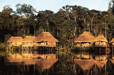
Cuyabeno
Wildlife Reserve
20 km
(12 miles) east of Lago Agrio lies the western
tip of the 606,000-hectare (1.5 million-acre) Cuyabeno
Wildlife Reserve, founded in 1979 to protect the rainforest
from encroachment by oil companies and settlers. The area
is considered to be one of the most important areas of natural
beauty and ecological diversity in the Amazon basin. Its dense
primary jungle forest is home to various Indian groups, including
the Cofán, Siona, Sequoia and Shuar. There is also
abundant bird life and myriad rare and exotic plants and creatures,
from pink dolphins, caiman, electric eels, manatees and anacondas
to jaguars, tapirs, agoutis, peccaries, armadillos and tortoises.
Unfortunately,
despite its protected status, oil and logging companies have
ravaged much of the region. Wells have been drilled, roads
built, forests cut down, and millions of gallons of raw crude
oil have been spilled into its rivers, creeks, swamps and
lagoons. During the last 20 years, spills from the trans-Ecuadorian
pipeline, which Texaco built in 1972, totaled 72 million
liters (16 million gallons), half again more than was
spilled in the Exxon Valdez accident. Spills
such as these contribute to high rates of malnutrition and
health problems among the local indígenas, including
birth defects and neurological disorders. In recent years,
following the enlargement of the reserve in 1991, Indian organizations
and conservation groups have fought to save the rainforest
from more destruction (see the gringo chief, below). The international
NGO Conservation International has been at the forefront of
projects to improve park infrastructure and protection.
Despite
massive damage, vast areas of the Cuyabeno and its surroundings
are untouched and unspoiled, so that visitors to the park
may see no evidence of the environmental spoilage and contamination.
Local people play a increasingly active part in tourism, and
there are number of lodges and camps where visitors can experience
the rainforest in all its pristine beauty. To an extent, ecotourism
is seen as a viable and less-destructive alternative to the
petrodollar, and has played an important role in saving parts
of this precious rainforest. The entrance fee to the park
is currently $20 per person from July to September, and $15
the rest of the year. The rainiest months run from March to
September.
Tours
of the Cuyabeno
Many
Quito-based companies organize tours in the area. Native
Life Travels tel (022) 550836 fax (022) 569741, J
Pinto 446 and Amazonas, run by indígenas from
Cuyabeno, have a good reputation and their prices are reasonable.
Nuevo Mundo Expeditions tel (022) 564448 fax (022)
565261 nmundo@interactive.net.ec
www.nuevomundotravel.com
, Coruña N26-207, have a reputation of being ecologically
sensitive and organize tours to the Cuyabeno River Lodge.
Its owner, Oswaldo Muñoz, has been an inspirational
leader of the Ecuadorian Ecotourism Association since its
inception. They offer special shamanism and natural healing
programs.
Several
tour companies in Lago Agrio organize less expensive tours
to Cuyabeno Wildlife Reserve and the surrounding area. You
might also want to contact the "Gringo Chief" Randy
Borman, who runs tours to his part of the reserve: tel (022)
470946 cofan@attglobal.net
. Check out the Cofán website www.cofan.org.
The
Huaorani Reserve
The
traditional home and hunting grounds of the Huaorani rainforest
people have been in the Napo area for millennia. In the past
few years, however, their land and lifestyle have been damaged
and mightily disturbed by the petrochemical and tourist industries.
The Huaorani reacted by imposing tolls for the use of their
rivers, and entrance fees to their communities, most of which
are now part of the Huaorani Reserve south of Coca. Sometimes
they demand gifts, which oil companies usually pay because
it helps them in obtain concessions.
Travelers
who want to visit the Huaoranis, and are sensitive to their
situation should read the excellent and highly-recommended
book, Savages by Joe Kane. One quote from the Huaorani
Moi Enomenga sums up their position: "We do not want to be
civilized by your missionaries or killed by your oil companies.
Must the jaguar die so that you can have more contamination
and television?" But there are many more.
Tropic
Ecological Adventures runs a program with the Huaorani,
where visitors spend a few nights in Huaorani territory and
experience their way of life. Andy Drumm, the founder of Tropic,
is a Fellow of Britain's Royal Geographical Society, an advisor
to the Huaorani people and works with Moi Enomenga. The company
recently won a category in the prestigious ToDo! Ecotourism
awards. For more information contact tel (022) 225907 fax (022)
560756 e-mail tropic@uio.satnet.sat
www.tropiceco.com
, Avenida República 307 and Almagro, Edificio "Taurus,"
Dpto. 1-A, Quito.satnet.sat;. Other tour operators with good
relationships with the Huao are Kem Pery Tours and
Safari Tours .
Parque
Nacional Yasuní
Ecuador's
largest mainland park, Yasuní extends over a whopping
962,000 hectares (2,376,140 acres). It protects a range of
rainforest habitats from forested hills, to periodically-flooded
and inundated lowlands. Although it was first established
in 1979, the boundaries of the park were extended eastwards
following the creation of the Huaorani Reserve in 1991. The
park is renowned for its huge biodiversity, although to date
little of it has been studied. Recognizing its importance,
UNESCO declared it a biosphere reserve and many conservationist
groups have been involved in its protection. The park faces
serious threats from the oil industry: the Maxus consortium
enjoys exploration rights in the park for instance. Thankfully,
the road Maxus and its predecessor Conoco built has been maintained
off-limits for colonizers, and environmental damage from exploration
kept to a comparative minimum. The park is extremely remote,
and seldom visited. However lengthy tours can be arranged
with guides from Coca agencies, as well as the Quito-based
ones.
 THE
COAST THE
COAST
In
the north, the local organization, SUBIR, runs
projects with the communities of San Miguel and Playa de Oro
upstream, as well as trips into the remote Cotacachi-Cayapas
Ecological Reserve. They have an office in Borbón,
or in Quito tel (022) 528696 fax (022) 656990 subir@care.org.ec
. On a tributary of the Borbón, the Cayapas, you can
arrange to stay at the comfortable, moderately-priced (full
board) Steve's Lodge at the junction of the Cayapas
and Onzole rivers, owned by English-speaking Hungarian Stephan
Tarjanyi. For more information nagy@uio.satnet.net.
Reserva
Ecológica Manglares Cayapas-Mataje
Contact Fundación CIDESA
tel (022) 226303 or 527119, locally (06) 789143 e-mail cidesa2@cidesa.org.ec
in Limones has set up a project and can arrange visits to
mangrove forests of of the reserve.
Machalilla
National Park
Isla
de la Plata, named after the silver (plata) Sir Francis
Drake is reputed to have buried after a successful raid on
Spanish galleons, is part of the spectacular, 55,000-hectare
(135,850-acre) Machalilla National Park that also embraces
regions of dry tropical forest and cloud forest, a beautiful
coastline, islands and a number of archaeological sites. A
more visible form of treasure on Isla de la Plata is its wildlife,
almost as rich and varied as that of the Galápagos
Islands, but with the advantage of being concentrated in one
area. Frigate birds, waved albatrosses, occasional sea lions
and iguanas and three types of boobies are just some of the
stars of this insular animal kingdom. Dolphins and hump-back
whales can also be spotted between mid-June and early October.
The
great curving beaches around Los Frailes, just south
of Machalilla town but within the park itself, are some of
the finest in Ecuador; they are the most likely to appear
on travel posters. A trail from the main coastal road takes
you to the first white-sand beach overlooked by green hills.
A trail over the headland takes you to the other three beaches,
each in its own isolated cove, one of which has black sand.
Being part of the national park, there are no houses, the
landscape is unspoiled, the water clear and clean for snorkeling,
and often you have a beach or two to yourself.
Also
within the park, the archaeological site and museum
(open 8 am to 6 pm daily) at the village of Agua Blanca
are also worth visiting. Considered one of the most important
in Ecuador, the site is about five kilometers (three miles)
off the coastal road, just north of Puerto López .
If you don't have your own transportation, you can hike up
from the dirt road, or rent a truck or taxi in one of the
nearby towns. For more strenuous hikes into the mountains
(such as to the village of San Sebastián, 10 kilometers
(six miles) away at 600 m altitude), local guides are available
at Agua Blanca.
The
museum is full of jewelry, pottery and other objects from
the Manta culture that flourished in the area from bc 500
to 1500 ad, the time of the Spanish conquest. There is evidence
that the site was occupied by the much-older Machalilla, Chorrera
and Salango cultures. A photography exhibit shows that people
in the surrounding mountains and hills have the same features
as figures appearing in ancient Machalilla pottery. It is
thought that the area has been inhabited for at least 3,000
years, making it perhaps the longest continuously-inhabited
region of coastal South America. You can learn more about
these ancient coastal cultures at another museum in the coastal
village of Salango, south of Puerto López.
Practicalities
Most
local tour operators can be found in the fishing town of Puerto
López, just south of the park. Not all of them have
great reputations, and there are many 'unlicensed' operators
also hussling for business. When weighing up costs, consider
your safety too. The licensed operators employ boats with
two outboard engines, use life-jackets and radios, and have
basic toilets. The standard of the guide will also be dependent
on price. Tours require a minimum of four people, and you
may have to pro-actively seek other people to make up numbers.
Tours to Isla de la Plata can be arranged in Puerto Cayo,
or at Machalilla and Puerto López,
but the latter is probably the easiest. Renting a five-passenger
boat is about US$100, or joining a group will cost about US$30
per person, not including the park entrance fee of US$20 from
July to September, and $15 from October to June. Boats leave
in the early morning and return in the afternoon for the one
to one-and-a-half hour journey. The crossing is often very
rough, so take seasickness tablets and bring waterproof gear.
As well as the wildlife on the island, there are good walks,
a pre-Columbian archeological site, coral reefs (the only
ones on the coast of Ecuador) and great snorkeling. Dubbed
the "Poor Person's Galápagos," Isla de la Plata is
included by Quito travel agents in tours of this area of Manabí.
In Puerto
López, recommended operators include Bosque Marino
Tours tel (05) 604221, General Córdova, Machililla
Tours tel (05) 604154, Malecón and Julio Zuleta,
and Exploratur tel (05) 604128 explora1@uio.satnet.net , Malecón at General Córdova, which can also
organize scuba diving trips with advance notice. A good tour
operator employing local guides for trips up in to the hills
around Agua Blanca is Comuna Agua Blanca Tours tel
(05) 604168, on General Córdova.
SOUTH
About
15 km (nine miles) west of Guayaquil on the main road,
the Bosque Protector Cerro Blanco,
a private reserve set up and run the local cement works and
the Fundación Pro-Bosque. The small reserve protects
some 3,500 (8,645 acres) of tropical dry forest, home to over
200 bird species and plenty of mammals such as howler monkeys,
kinkajous and jaguars. Contact Fundación Pro-Bosque
tel (042) 416975 or 417004, Edificio Promocentro, Cuenca
and Eloy Alfaro, in Guayaquil, for more information about
the park and guided tours. They can also take you on tours
of the Manglares Churute
Ecological Reserve,
(south of Guayaquil), one of the few areas of mangroves left
on the coast. The reserve is home to some 200 species of bird,
including flamingo from October to December, and also bottle-nosed
dolphins between June and November. Boat rides can be arranged
through the mangroves, and there are some great trails through
the dry forest. The Centro de Visitantes is just off the main
highway, and the reserve is open 8 am to 2 pm (get there early
to avoid the sapping heat). For more information, contact
the Ministerio del Ambiente in Guayaquil, tel (042)
397730, Avenida Quito 402 and Padre Solano.
|


